

I'm very excited as I just got a date (1st April) for launching/getting on our mooring.
A trip from Falmouth to Fowey is planned as the first real expedition - I've not been out of Falmouth Bay so far.
With this in mind my thoughts have turned to passage planning, and (having just competed in the Virtual Vendee Globe:)) I naturally wanted to find some suitable weather routing software. Don't laugh...too loud.
Anyway, having looked at some of the options, and discarding most due to cost, I came across https://www.fastseas.com . It looks pretty good and intuitive and is donationware.
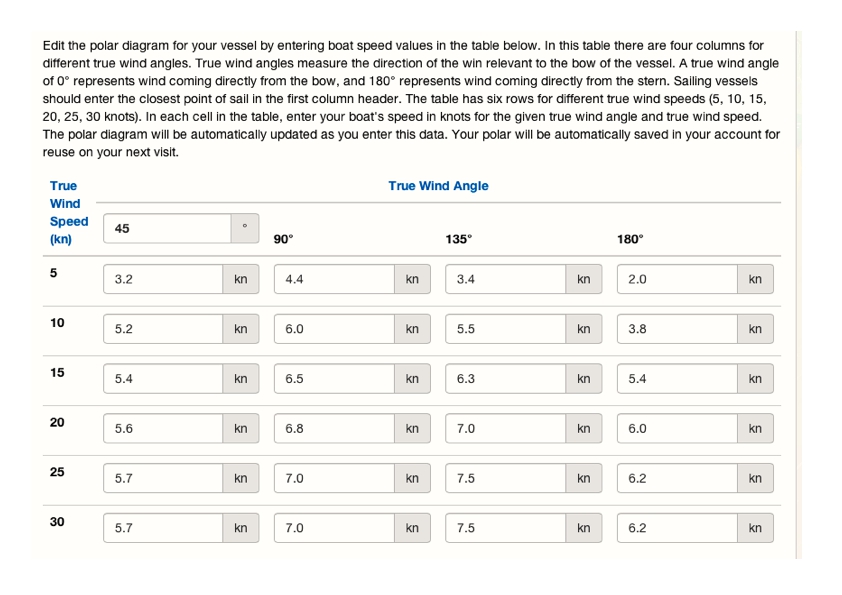
Obviously to use it I need to input some estimated Polar Data for my Mac. I've attached a pic of what I thought. Basically it's simply 80% of the default figures used by the app
What do you think?
My Mac polar estimate 2
MacGregor 26M 2009 - Sky's the Limit - Suzuki DF50